Saturday, July 28, 2012

Lake Conroe: Cagle to Stubblefield

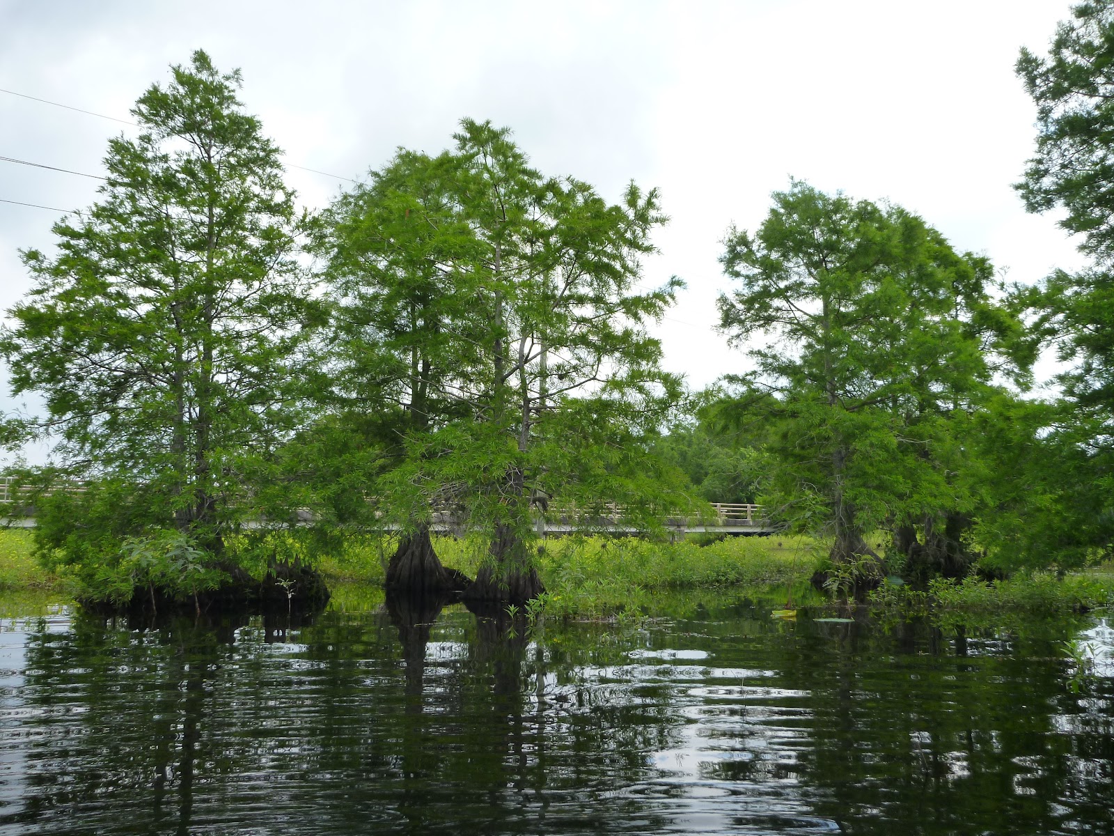
The key attraction of the northern section of Lake Conroe is the scenery of the Sam Houston National Forest which surrounds it. The plan for today was to launch at the Cagle Recreation Area, paddle up to the lake's northern edge, and then continue up the river channel to the launch near Stubblefield Lake. We shoved off from Cagle under an overcast sky a little after eight in the morning. A light breeze was in our faces as we turned north, passed under the FM1375 bridge, and crossed over to the west side of the lake. 

As we followed the shoreline northward, the sights and sounds of civilization began to fade away. The sounds of cars crossing the bridge were replaced by the calls of birds: the irritated croak of a blue heron as we disturbed his fishing, the cheerful song of a male cardinal perched near the edge of the lake, the trill of a pileated woodpecker deep in the woods. The morning clouds began burning away, leaving behind a clear blue sky and bright sunshine.

Once we reached the northernmost section of the lake, the shore became lined with a band of rattlebushes, a legacy of last year's drought. With its low point last year being almost 6 feet below today's level, much of the lake bed in this area was exposed and hospitable for growth. As we continued forward, the rattlebushes closed in and the open water disappeared completely.

We knew that the deeper and presumably unobstructed channel of the West Fork was nearby, but how could we get to it? One option was to backtrack and see if we could find the channel entrance on the east side of the lake, in the direction of Wildwood Shores. But retreat is always bitter. Instead we looked around until we found a spot where the rattlebush thicket was less dense and there was a hint of open water in the distance. From there we set off "cross country" through the bushes using a combination of push-polling and dragging ourselves from bush to bush -- all while being showered with bits of leaves, seed pods, and the occasional spider.


Then suddenly we were through into the open waters of the West Fork. After that it was an easy paddle up to Stubblefield Lake. We picked a shady spot on the shore to relax for a bit and eat a picnic lunch. Thus fortified, we returned to the water. We dodged the ever present fishing lines and crossed under the bridge at Stubblefield Lake Road to continue upstream. We'd only gone about a half mile more when the warmth of the afternoon overwhelmed our collective sense of adventure. We turned back to the launch where we found a group of butterflies were waiting to welcome us.


Sunday, July 22, 2012

Cruising the Shaded Waters of Luces Bayou

After hearing good things about Luces Bayou from people in my paddling group, I finally got a chance to visit. It proved to be a great place to paddle on a warm summer day. The bayou is fairly wide at our launch point at Ponderosa Marina. From there you can either paddle downstream toward Lake Houston or upstream toward the bayou's headwaters.

We chose the upstream option and found ourselves in a gradually narrowing channel heavily shaded by cypress trees. We paddled beneath a couple of bridges and past a few houses and camps, but overall the setting is very natural and unspoiled. After paddling about three and a half miles, the bayou was obstructed by some broken concrete, an old metal culvert, and some fallen trees. We decided that was the right time to turn around, but I'll definitely be coming back.

Wednesday, July 4, 2012

Independence Day on Lake Houston

I marked this Independence Day with my very first visit to Lake Houston. A group of us gathered at Deussen Park to paddle, picnic, and celebrate the birth of our nation.

The water was fairly calm during our morning paddle and we explored a pretty little tributary off to the west of the park.

Later in the day the wind and and assortment of power boats stirred up the water but that didn't prevent us from making an afternoon voyage to the east, past the spillway and to the other side of the lake.

Mother nature even chipped in with some fireworks, as a little thunderstorm chased us back to the park a the end of our second paddle. Overall, it was a great July 4th!

More Pictures from Lake Houston

Sunday, June 24, 2012

A Quick Trip to Sheldon Lake

It feels like I was everywhere but on the water during June. First up was a visit to my parents in Louisiana. Next was a fairly standard visit to the office up in Richardson, Texas. Then out of the blue came a trip to White Plains, New York. And just like that,the month was almost over.

Before the last days could slip away, I scheduled a quick outing to Sheldon Lake. I was a bit surprised to find the water level down a few feet despite the wet weather. When we talked to the ranger during our picnic lunch, we found they had intentionally lowered the level to enable some road construction at the new park entrance off Garrett Road.

Partly because of the lower water levels and partly due to the normal summer cycle, the lotus and other water plants had grown up significantly since my last visit, reducing the amount of water open for easy paddling.  Still, it was very welcome to get out on the water and enjoy the sight of the egrets, herons, ibis, spoonbills and other water birds that make their homes on this lake.

My resolution for July is spend many more hours on the water!

Saturday, May 26, 2012

Lake Conroe: North to Cagle


Memorial weekend provided a perfect opportunity to return to Lake Conroe. The lake suffered greatly during last year's drought but winter and spring rains have nearly restored it. We launched from private property in the Walnut Cove subdivision and headed west down a canal.

Water birds like this Great Blue Heron were out in full force as we paddled the sheltered waters. Once we reached the open lake, power boats and jet skis became more common sights.

The wind freshened as we passed in front of the Corinthian Point Yacht club and headed north. Soon we were leaving the jet skis and development behind and entering the bounds of the Sam Houston National Forest.

A convenient beach beckoned and we paused for a rest, a snack, and for some of us, a swim. Once everyone was sufficiently recharged, we headed north again. Aside from a few scattered fishermen, we had the lovely scenery of the lake more or less to ourselves.

About the time that the day started to grow uncomfortably warm, the dock at the Cagle Recreation Area came into view. We made our way to shore to enjoy some shade and a snack while waiting for our ride back to Walnut Cove.

What a great paddle! Next on my list for this lake is the run from Cagle up to Stubblefield.

More Pictures from Lake Conroe

Sunday, May 13, 2012

Seeking Carpenter's Bayou

Spring paddling season is off to a good start here in Houston. Generous winter and spring rains have mostly refilled the nearby lakes and streams that were depleted by last summer's drought. And I've been lucky enough to make it out onto the water a number of times. I had my first experience with surf paddling (and some surfing lessons) down at Surfside Beach on a very windy day. I paddled about ten miles on Armand Bayou, upstream and down from Bay Area Park. I attended Austin Kayak's spring "Demo Days" event and was able to try out a number of new boats. And I glided through the cypress trees and water lilies on Sheldon Lake for the first time since last summer when low water led to its closure.

You might be wondering (if you aren't, please humor me) why I haven't posted anything if I've been doing all of this paddling? Good question! One reason could be because all of the posts from my Ozark adventures depleted my stock of words.

But the larger reason is that this spring most of my trips have been with a group from the Kayaking in Houston Meetup. It's been great meeting new paddlers and adding a larger social dimension to paddling, but it has cut down dramatically on my picture taking. It's partly that the noise of a large group scares away some of the wildlife I might have photographed. But also as I have gotten more involved with organizing these outings, I've taken less time to "stop and photograph the roses" (or water lilies, as the case may be). I'll have to work on that.

After paddling with the group on Sheldon Lake this Saturday, I went back for a solo paddle on Sunday. In my prior visits to the lake, I've never been able to paddle all of the way up to the lake's northern boundary and beyond into Carpenter's Bayou. During my first few trips, I didn't even try. And then as last summer progressed, the water levels got too low and the vegetation too dense to allow it.

My trip with the group on Saturday led me to believe things had changed. The water level in the lake was only about a foot and a half below the maximum and the vegetation levels were well below their full summer density. I set out from the launch on Pineland Road and headed generally north, more or less hugging the western boundary of the lake. The first couple of miles were quite easy, as I mostly just retraced my route from the day before. But the last mile grew a bit trickier. The water depth kept decreasing as I traveled farther north. In addition to the beds of water lilies, there were areas of aquatic grasses which clogged the channel, tangling my paddle blade as I tried to pass through.

At one point I thought I'd reached a dead end. I could see the power lines along Garrett road up ahead, but in front of me was a fairly dense bed of reeds growing in the shallow water. I didn't want to give up but didn't see any reasonable way through. Finally I stood up (very carefully) in my kayak for a look around. What a difference a few feet of height makes when in a marshy environment! From the higher vantage I could see that there was actually quite a bit of open water in front of the Garrett Road bridge, and that it appeared to extend to a point not too far to my left. I backtracked twenty or thirty yards and then picked my way towards where I'd seen the open water, forcing my way through a few narrow bands of reeds and aquatic grasses along the way. Then suddenly there was only open water (relatively speaking) between me and the bridge. Victory!

I cruised under the bridge, needing to duck slightly, and Carpenter's Bayou opened up before me . . . and then closed again almost as quickly. After only a brief stretch of open water, the left side of the channel was blocked by masses of tall flowering grasses. To the right, the channel passed into a fairly dense grove of cypress trees. I made my way into the trees, tied up to a cypress knee, and had lunch while listening to the chatter of the birds.

After lunch I explored the cypress grove a bit more but didn't find anything resembling a clear channel to proceed upstream. Eventually I turned south again and picked my way slowly back into the more open waters of Sheldon Lake.

On the way back to the launch I took a side trip to the spillway and landed there, taking a few more minutes to look around enjoy the day before heading for home after a very enjoyable seven mile paddle.

More Pictures from Sheldon Lake


Sunday, April 1, 2012

Spring in the Ozarks: Farewell

On the final full day of my trip, I slowed things down a bit. I spent a leisurely morning at the cabin, ate an early lunch, and then drove through Ponca and up the mountain behind it. The activity of the day was a Zip Line Canopy Tour. Jumping off of the platform for the first time didn't turn out to be scary, but my stomach did a flip the first time I reached maximum speed, hit the low point on the cable, and started back up. It was all down hill from there (sorry, couldn't resist). The only major down side to the whole experience was that when we were finished, they informed us that they had another zip line course with runs that are faster. It's not fair to tell me that on my last day!

The canopy tour was the last major event on the agenda for the trip. I headed back to Foggy Hollow, cleaned up a bit, and visited the cafe for a last delicious dinner. After that, it was time to start packing my things for an early departure the next day.

When Sunday morning came, I was up before the birds and had one last breakfast on the back porch. As I dressed and loaded the car, the mist was slowly lifting from the valley. Too soon I was saying farewell to my home away from home and heading up the driveway for the last time, at least for this trip.

I turned toward Jasper and then south on Arkansas Highway 7. Like the highway I arrived on, "Scenic 7" is winding and steep and gave me a good chance to say farewell to the Ozarks before depositing me back on I-40 near Russellville. The remainder of the trip home was uneventful. By the time I'd covered around 500 miles I was running out of patience with Sunday drivers, but by around mile 580 I was pulling into my own driveway and found my comfortable house waiting for me.

I was happy to be off the road and in some ways I was glad to be home. But I carried good memories of the Ozarks back with me, and perhaps left a bit of myself behind in those valleys.