Spring paddling season is off to a good start here in Houston. Generous winter and spring rains have mostly refilled the nearby lakes and streams that were depleted by last summer's drought. And I've been lucky enough to make it out onto the water a number of times. I had my first experience with surf paddling (and some surfing lessons) down at Surfside Beach on a very windy day. I paddled about ten miles on Armand Bayou, upstream and down from Bay Area Park. I attended Austin Kayak's spring "Demo Days" event and was able to try out a number of new boats. And I glided through the cypress trees and water lilies on Sheldon Lake for the first time since last summer when low water led to its closure.
You might be wondering (if you aren't, please humor me) why I haven't posted anything if I've been doing all of this paddling? Good question! One reason could be because all of the posts from my Ozark adventures depleted my stock of words.
But the larger reason is that this spring most of my trips have been with a group from the
Kayaking in Houston Meetup. It's been great meeting new paddlers and adding a larger social dimension to paddling, but it has cut down dramatically on my picture taking. It's partly that the noise of a large group scares away some of the wildlife I might have photographed. But also as I have gotten more involved with organizing these outings, I've taken less time to "stop and photograph the roses" (or water lilies, as the case may be). I'll have to work on that.
After paddling with the group on Sheldon Lake this Saturday, I went back for a solo paddle on Sunday. In my prior visits to the lake, I've
never been able to paddle all of the way up to the lake's northern boundary and beyond into
Carpenter's Bayou. During my first few trips, I didn't even try. And
then as last summer progressed, the water levels got too low and the
vegetation too dense to allow it.
My trip with the group on Saturday led me to believe things had changed. The water level in the lake was only about a foot and a half below the maximum and the vegetation levels were well below their full summer density. I set out from the launch on Pineland Road and headed generally north, more or less hugging the western boundary of the lake. The first couple of miles were quite easy, as I mostly just retraced my route from the day before. But the last mile grew a bit trickier. The water depth kept decreasing as I traveled farther north. In addition to the beds of water lilies, there were areas of aquatic grasses which clogged the channel, tangling my paddle blade as I tried to pass through.

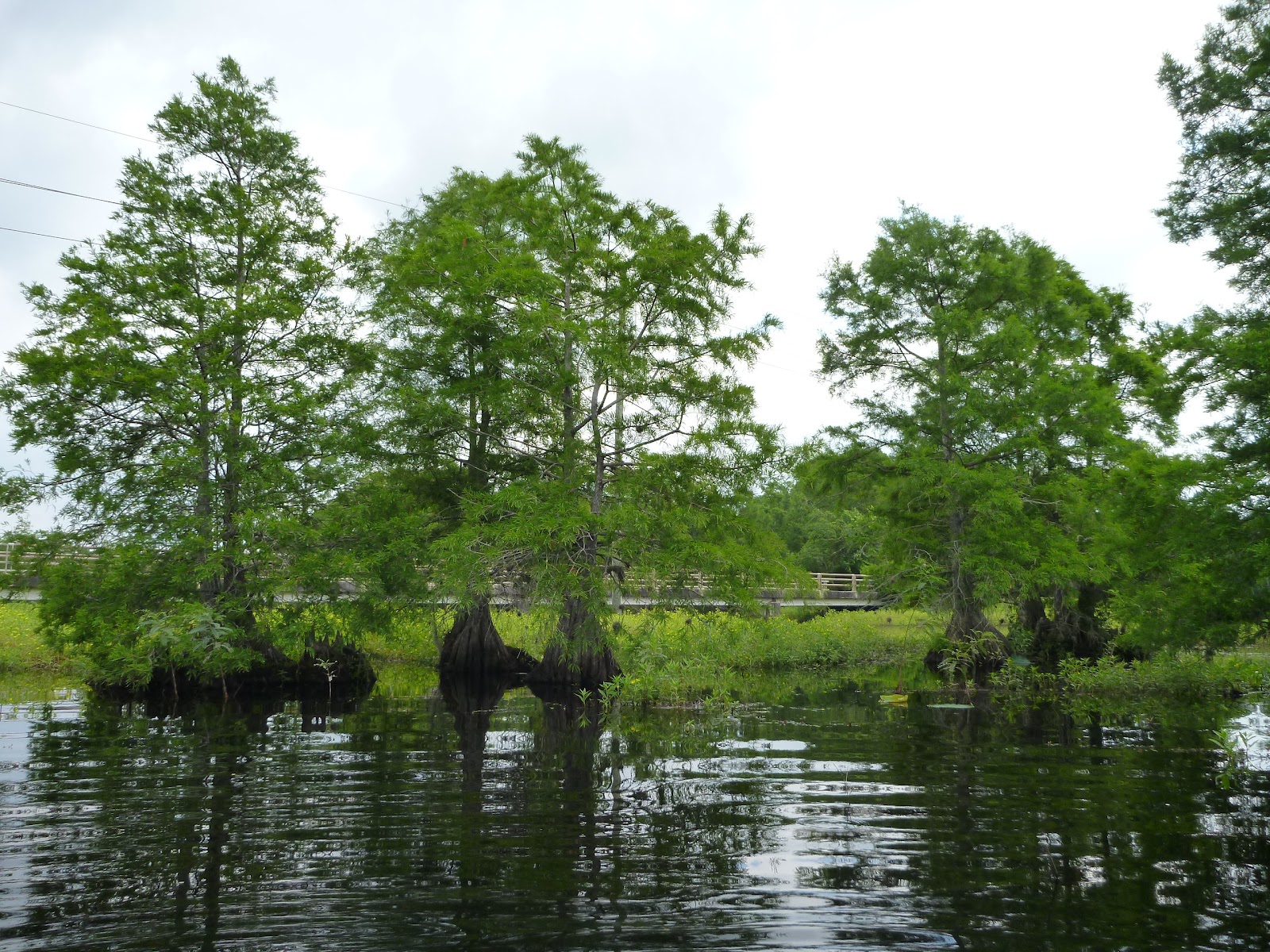
At one point I thought I'd reached a dead end. I could see the power lines along Garrett road up ahead, but in front of me was a fairly dense bed of reeds growing in the shallow water. I didn't want to give up but didn't see any reasonable way through. Finally I stood up (very carefully) in my kayak for a look around. What a difference a few feet of height makes when in a marshy environment! From the higher vantage I could see that there was actually quite a bit of open water in front of the Garrett Road bridge, and that it appeared to extend to a point not too far to my left. I backtracked twenty or thirty yards and then picked my way towards where I'd seen the open water, forcing my way through a few narrow bands of reeds and aquatic grasses along the way. Then suddenly there was only open water (relatively speaking) between me and the bridge. Victory!
I cruised under the bridge, needing to duck slightly, and Carpenter's Bayou opened up before me . . . and then closed again almost as quickly. After only a brief stretch of open water, the left side of the channel was blocked by masses of tall flowering grasses. To the right, the channel passed into a fairly dense grove of cypress trees. I made my way into the trees, tied up to a cypress knee, and had lunch while listening to the chatter of the birds.
After lunch I explored the cypress grove a bit more but didn't find anything resembling a clear channel to proceed upstream. Eventually I turned south again and picked my way slowly back into the more open waters of Sheldon Lake.
On the way back to the launch I took a side trip to the spillway and landed there, taking a few more minutes to look around enjoy the day before heading for home after a very enjoyable seven mile paddle.
More Pictures from Sheldon Lake

No comments:
Post a Comment