Friday, March 30, 2012

Spring in the Ozarks: Lost Valley

I returned to Lost Valley for the last hike of my trip. It's a relatively easy trail in a very accessible location but there's a great deal of beauty per acre. While I enjoyed it during my fall visit a couple of years ago, the greater volume of running water this time made it even more special.

The trail follows Clark Creek as it winds through the wooded valley, passing the Natural Bridge and Cob Cave before finally reaching Eden Falls.

On this visit I headed straight back toward the main falls, but I was sidetracked by the sound of falling water to the left of the trail. A short scramble led me to this pretty little moss-covered cascade. I paused to admire and then returned to the main trail. A few minutes later I could hear and see Eden Falls in front of me.

After enjoying the falls from below, I climbed the steeper trail to the mouth of Eden Falls Cave where Clark Creek emerges to create the falls. 

I'd brought flashlights with the intention that this time I'd make my way to the underground falls hidden at the back of the cave. I did make  it deeper into the cave than on my prior visit, but I chickened out at the point where the cave height reduced me to a crawl.

After retreating from the the cave and taking another opportunity to admire the falls, I worked my way back to to the Natural Bridge. I climbed down into the creek bed and worked my way through the bridge from the rear until I had a view of the pool beneath it. Then I returned to the trail and looped around to get this lovely frontal view of water pouring from beneath the bridge.

From here it was just a leisurely stroll back to the trailhead. The popularity of this little valley is such that despite it being the shortest hike I took during trip, it's also the trail where I saw the most people. There wasn't exactly a crowd, but periodically the valley would echo with the excited sounds of children's voices.

While I'm often a fan of peace and solitude, I couldn't help but smile as I listened to them. After all, if my folks hadn't planted the love of the outdoors in my heart by bringing me to places like this as a child, maybe I wouldn't have been in Lost Valley at all.

More Pictures of Lost Valley

Wednesday, March 28, 2012

Spring in the Ozarks: Smith Creek Preserve

Luck was with me in a couple of different ways on Wednesday and both related to the Low Gap Cafe. The cafe opened a few months ago in an unassuming building that once served as the Low Gap General Store. It is closed on Monday and Tuesday so this was my first real chance to try a meal there despite passing it on the way to my cabin every day.

My first bit of luck was in choosing to eat there at all. My order on this first visit was just a sandwich and fries, but the sandwich was especially tasty and the fries were cooked perfectly. I got the idea that somebody at the cafe took pride in their food. After that I ate one meal per day there. From the hamburger to the filet mignon, I was never disappointed and I never went back to the Ozark Cafe. My only regret was that I had to pass up the triple chocolate cake due to a Lenten sacrifice.

Another notable thing about the Low Gap Cafe (aside from the hitching post incident mentioned here) is that they feature free WiFi in an area rather starved for Internet access. I was using their WiFi to do a bit of research on hiking destinations when good fortune smiled for a second time. A man named Michael Dougherty approached me and introduced himself. He is the president of the Buffalo River Chamber of Commerce and an avid photographer.

In preparing for my Monday and Tuesday float trips, I had already made use of some great information from his web site including GPS-annotated topological maps and river level references. Michael joined me at my table and we talked hiking and photography for about twenty minutes. Among other things, he said that the chance for a spring hike at the Nature Conservancy's Smith Creek Preserve was an opportunity not to be missed. The preserve protects 1,226 acres along Smith Creek above Boxley Valley. In addition to its surface beauty, it sits above Sherfield Cave which is home to Arkansas's largest population of Indiana bats. Since I had already been considering a visit to Smith Creek, his advice sealed the deal.

Once I finished my lunch, I packed my gear and headed for the preserve. When I arrived at the trailhead, I had the entire place to myself. My first goal was to find  my way to QuiVaLa Elise Falls. Using the directions from Tim Ernst's Arkansas Waterfalls Guidebook, I followed a fairly faint path (really more of an overgrown old jeep trail) until I reached a dry creek bed at the bottom of a hollow. After following the creek bed for a time, a small stream joined from the left and I heard the sound of falling water. A short scramble up this stream led to the waterfall on the right.

I soaked in this view for a time, then climbed back out of this hollow and followed the main trail downhill into another one. As soon as the path reached the bottom of the second hollow it turned and ran along Smith Creek for several miles. As the trail made its way through the woods, it crossed smaller streams coming to join the creek and passed little springs, sinkholes, wildflowers, dogwoods, redbuds, butterflies, and more.

The most striking portion of the hike was a section of the creek where huge boulders and a fractured limestone bed created a series of cascades. It was breathtaking. I clambered over the boulders to explore the cascades from all angles, then continued down the trail until it finally crossed the creek and faded away away into the woods.


I was in no hurry to leave, but eventually I retraced my steps back to the trailhead. A vehicle from Missouri was parked there when I returned, but I never saw the driver or anyone else. It was truly an afternoon of peace and beauty.

More Pictures from Smith Creek Preserve


Tuesday, March 27, 2012

Spring in the Ozarks: Buffalo National River

At the heart of this trip was the beautiful Buffalo River. From its headwaters in the Ozark National Forest to its confluence with the White River, this stream flows clear and unobstructed over its entire length.The headwaters are protected by the National Forest Service as a Wild and Scenic river. The lower 135 miles are managed by the National Park Service and were designated as the country's first National River (see map).

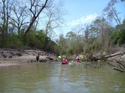
On my first and second full days in the area, I rented a kayak and paddled the ten mile stretch of river from Ponca to Kyles Landing. Heavy rains the prior week had sent the upper Buffalo into flood stage for a few days, but by Monday the water levels had receded enough to offer an ideal float.

In this stretch, the river's turquoise waters flowed through forested valleys, past steep limestone bluffs, and through of a series of moderate rapids.


Along the way the river passed numerous creeks and sandbars that offered opportunities for relaxation and exploration.

One other thing I found as I floated along is a collection of really friendly people. Other paddlers were eager to tell me about their favorite sections of the river, their favorite trails and waterfalls, and some of them, their life stories. And on the couple of occasions where a rapids got the better of someone, they were also eager to help gather up lost possessions before they floated away.

On my fourth full day I returned to hike the Buffalo River Trail from Ponca to a bit beyond Steel Creek and back. The trail wound along the hillsides and bluffs, giving me a chance to enjoy the Buffalo from a slightly different perspective.


More Pictures from the Buffalo National River

Sunday, March 25, 2012

Spring in the Ozarks: Foggy Hollow


After reaching Buffalo National River,  the first items on the agenda were arranging a float trip for the next day and having lunch at the Ozark Cafe in Jasper. But the next order of business was to pick up my key and settle into my Ozark refuge, the Foggy Hollow Cabin at Low Gap. This cabin sits on sixty acres of hillside overlooking the Steel Creek Valley between Ponca and Jasper.

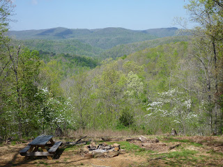
It is lovely both inside and out, and has most of the comforts of home. But best of all, it has amazing back porches with views of the valley below.


These porches became the focus of my routines for the seven nights I stayed there. In the morning I'd have breakfast there, listen to the birds awaken, and the watch the mist slowly recede into the deepest hollows. In the evening I'd watch the sun descend and the stars come out, while bats and lightning bugs came to dance around the cabin. As the nights grew quiet, the sound of the creek splashing its way down the ridge would carry to the porch.

At night it got truly dark, so the stars and moon were exceptionally bright. In addition to the bats and lightning bugs, there were numerous moths that would flutter around any source of light. And on my first night there,  a chorus of coyotes sang me a lullaby.

During the day the woods were filled with birds including crows, titmice, nuthatches, bluejays, and woodpeckers -- including pileated woodpeckers. On two different mornings, flocks of wild turkeys passed through the yard. I saw evidence of deer near the pond but never actually spotted one.

A few observations might help convey the seclusion of this area:
  • The traction control system on my RAV4 frequently engaged when heading up the rather steep gravel driveway in the morning.
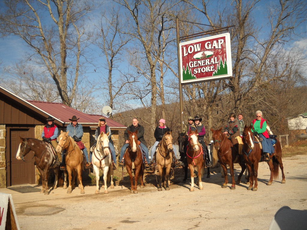
  • I was once obliged to move my car while having lunch at the excellent cafe just up the road in Low Gap. Why? I was blocking the hitching post when a group of riders came through.
  • Mobile phone coverage is so spotty that on several evenings I found myself driving to a nearby hilltop to get enough signal to check the weather and send a few emails. 
All in all Foggy Hollow was a beautiful serene haven tucked into the hills. And it served as a perfect base of operations for my Ozark adventures.

More Pictures from Foggy Hollow

Spring in the Ozarks: Arrival

The second day of my trip started early. After a shower and a quick breakfast, I checked out of the hotel and headed to the local supermarket to pick up a few perishables for the week ahead. Access to a large grocery store can be difficult once you get into the hills. Soon afterwards I was driving west on I-40 on yet another beautiful day.

As I neared Lake Dardanelle, I kept my eyes open for bald eagles. On my previous trip through the area I spotted one taking off from a tree near the lake and flying over the interstate. On this day, however, I saw only vulturas soaring over the roadway and white pelicans wheeling over the lake.

In the nearly five hundred miles I covered on the prior day, I gained only two hundred feet of elevation. In the sixty miles between Conway and Clarksville, I quickly gained another two hundred. And that was just the beginning. At Clarksville I left the interstate and turned north.

Soon I was entering the Ozark National Forest on Arkansas Highway 21, an Ozark Highlands Scenic Byway. A highway sign read Crooked and Steep Next 20 Miles and it was true. The road starting winding its way up into the hills with numerous ten and fifteen MPH curves along the way.

As the highway climbed, spring took a few steps backwards. Some of the hardwoods were still bare while others showed pale green leaves that were just beginning to open. In the understory, redbud trees were in the final stages of their show just as the pale dogwoods were getting started. Taken together, they made for a lovely medley.

After winding through the forest for an hour or more, the highway descended from the national forest and entered the bounds of Buffalo National River at Boxley.

During my last visit to the area in the fall of 2010, the river was completely dry here. Heavy rains the prior week led to expect a different story this time and I wasn't to be disappointed. The Buffalo was flowing vigorously at the Boxley bridge and that boded well for the entire trip. This time my explorations would have the sound of running water as background music.

The creeks, springs, waterfalls, and the Buffalo River itself would be my playground for the next seven days.

Saturday, March 24, 2012

Spring in the Ozarks: Outward Bound


After a year and a half of only short excursions, the opportunity for a longer trip was finally at hand. The destination was the Ozark Mountains of northern Arkansas and the Buffalo National River. The goal was a week of relaxation and recreation in beautiful unspoiled country.

The trip could have had a better start. Beltway 8 North was closed  at US290, so my most direct route out of Houston was blocked. As an alternate, I opted to take FM1960 East and rejoin the Beltway at Tomball Parkway. Unfortunately it seemed that every stoplight along FM1960 turned red as I reached it. It felt as though I was stuck in Houston's gravitational field and couldn't get free.

But after taking a few deep breaths for patience, I finally made it to the freeway and achieved escape velocity. I headed north on US59 and soon left Houston behind. The plan for the first day was to cross eastern Texas and southern Arkansas, bypass Little Rock, and stop for the night in Conway. From there it would be a short drive into the Ozarks the next day.

The weather was absolutely gorgeous. As I crossed eastern Texas, the contrast with late last year was enormous. The heavy rains of winter and spring have started  healing the wounds of last year's drought. The streams were flowing strongly, new green leaves were on the trees, and wildflowers were beginning to bloom along the highway.

Traffic was light and the miles went by quickly. Soon I was passing into Arkansas at Texarkana and crossing the Red River. A few hours later the impressive Arkansas River was behind me and I cruised into Conway with plenty of time to get checked in at my hotel before dinner.

An Outback Steakhouse within easy walking distance of the hotel satiated my appetite for food and drink. Afterwards I settled into my room for the night, excited about tomorrow's return to the Ozarks.

Sunday, March 11, 2012

Anticlimax

Last Saturday, one week before the Buffalo Bayou Regatta, a group of us made a test run of the course. The weather was beautiful and the current was slow. The rapids and strainers that plagued me on my prior upstream paddles barely slowed us down. Bring on the Regatta!


But Mother Nature had other plans. The clouds let loose the next Friday and the bayou started to rise. The weekend forecast didn't look much better but I wasn't going to let that stop me. On race day the first thing I did was check for updates. The regatta was still on, so I packed up and got ready to leave. I was just about to hit the road when I got word that the race was cancelled due to weather and water conditions. What a letdown!

Still, the weekend wasn't a total loss from a boating standpoint. On Sunday a hardy group of us braved the rain and met at Buffalo Run Park to work on our kayaking skills. Among other things, we voluntarily dumped ourselves out of our kayaks to practice solo and assisted deep water recovery. Let me tell you, the water was cold and the air wasn't much better once we climbed out!

Still, I learned some new tricks that should help me stay upright in the kayak, and got some good practice on recovering if needed. When and if they reschedule the Regatta, I'm ready!